Hiking in the Southern French Alps

From $1,175 pp

  • Duration

    7 days
  • Bookable From

    May - October
  • Trip Style

    Self-Guided
  • Country

    France
  • Physical Rating

    Average

Overview

Embark on a self-guided hiking adventure through the exquisite Dévoluy limestone massif in the Southern French Alps, armed with our essential tips for discovering the most spectacular spots!

This really is a self-guided walking adventure like no other. Select from an array of thoughtfully curated trails, suitable for all abilities, to explore the breathtaking vistas and secluded gems of the Dévoluy massif. Tailor your ideal walking holiday with the duration and hiking styles you prefer, leveraging our local insights and expertise. This walking holiday is entirely adaptable to your preferences.

Highlights

  • Selection of meticulously chosen trails for the finest paths and most splendid views
  • Tranquil routes, distant from popular walking spots
  • Diverse landscapes to explore, including forests, gorges, and peaks
  • Freedom to walk at a pace and difficulty that suits you
  • Guidance from enthusiastic local walkers, offering their expertise and advice
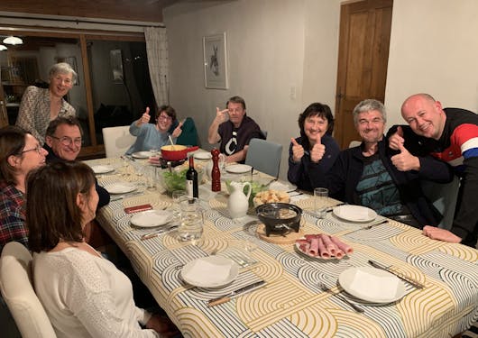
  • Enjoy a hearty home-cooked meal every evening, with a substantial breakfast and picnic lunch daily
  • Convenient train access from across Europe; no personal vehicle needed at the destination
  • Accredited by a sustainable tourism certification
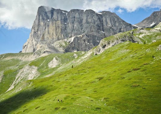
We have personally tried and tested every trail proposed on this self-guided walking holiday in the stunning Dévoluy Massif.

Each day, choose from half or full-day hikes for your self-guided adventure, some starting right at your doorstep, and others a short drive away. Your hosts will take you to and from the trailheads so you can enjoy walking without worrying about logistics, equipped with a paper map, GPX tracks, weather updates, and route info on your smartphone app.

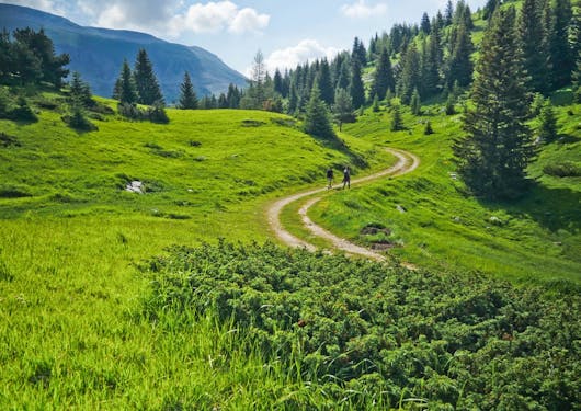
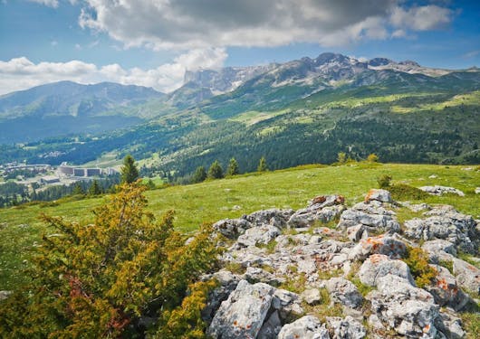
Discover the Dévoluy Massif's unique limestone geography, like a wild undiscovered version of the Dolomites, offering diverse experiences for all levels of walkers. Challenge yourself on steep slopes and rocky scrambles for panoramic views, or opt for gentler walks through gorges, alpine meadows, and serene forests. Encounter rich wildlife, from chamois and golden eagles to maybe even a wolf!

Over 20 exquisite walks and hikes in the dramatic Dévoluy Massif have been meticulously selected for your exploration. These range from routes starting directly from your accommodation to those that necessitate a brief transport to the beginning and back at the end, all conveniently scheduled throughout the week to streamline transportation logistics.

Once your booking is confirmed, you'll receive an app for your smartphone loaded with GPX tracks and detailed descriptions of each walk. Additionally, paper maps and face-to-face advice will be provided on-site, enabling you to tailor your walking and hiking itinerary to your preferences.

The following itinerary showcases a glimpse of the walks on offer to give an idea of the variety of walks available. Ultimately, it will be your decision what duration and difficulty of walks you choose to do each day.

See the FAQs to understand our walking and hiking grades.

Seasonal Notes

For a walking holiday in the Dévoluy Massif, the best times to visit would typically be late spring to early autumn. This period usually offers the most favorable weather for hiking.

  • Late spring (May to early June) can be delightful with fewer crowds, blossoming flora, and a fresh mountain atmosphere. However, some higher-elevation trails might still have snow, so it's wise to check trail conditions.
  • The summer months (late June to August) are generally warm and sunny, making them ideal for hiking. This is the peak season, so popular trails might be busier. It's also important to start your hikes early, to avoid the midday heat and potential afternoon thunderstorms.
  • Early autumn (September to October) is another great time, with cooler temperatures, fewer tourists, and the chance to see the fall colors. The weather can be more unpredictable during this period, so be prepared for variable conditions.

We recommend walking during the shoulder seasons (late spring and early autumn), if your schedule allows, to help combat overtourism and promote tourism dispersal.

Itinerary

Day 1 Veynes [France] (arrival day)

We will collect you at the train station in Veynes and take you to your accommodation where you will be warmly welcomed with a homemade hot meal for the evening.

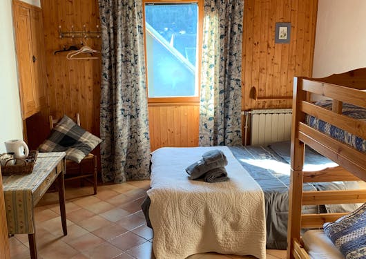
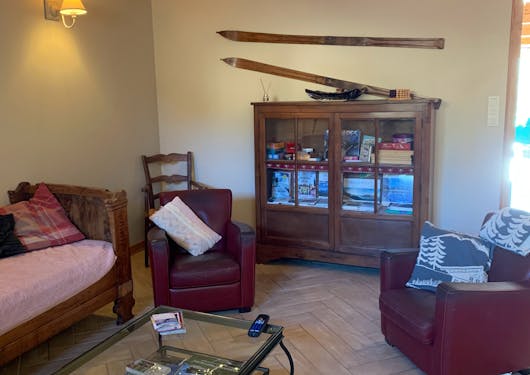
Accommodation: Boutique Guest House
Meals: Dinner

Day 2 Hiking in the Dévoluy - Easy or Moderate

These are just some of the walks available to choose from. You will have the option of walks from each level to choose from every day.

Easy | The Rif Gorges 
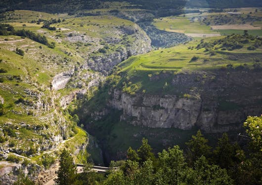
Discover the charming village of Saint Etienne en Dévoluy and its environs. The walk takes you to La Grésière plateau, offering a splendid view of Bure Mountain's northern face. Descend through the impressive Rif gorges, shaped by prolonged erosion.
Start: Accommodation
Duration: 3 hours
Distance: 7.7 km
Ascent: 330 m
Highest Point: 1532 m
Lowest Point: 1245 m
Terrain: Road, forest track, and trail

OR

Moderate | Tête du Tourneau (1906m) and Vallon Peak (2007m) 
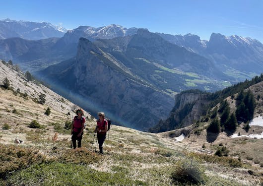
Enjoy a panoramic view of the Ecrins and the Drac Valley from La Tête du Tourneau, nestled between Col du Noyer and Col la Saume. Combine this with ascending the picturesque valley behind Tête de Girbault.
Start: Accommodation
Duration: 4h 30min
Distance: 12 km
Ascent: 645 m
Highest Point: 1,906 m
Lowest Point: 1,261 m
Terrain: Paths, road, and trails (sometimes steep)

Accommodation: Boutique Guest House
Meals: Breakfast, Picnic Lunch, Dinner

Day 3 Hiking in the Dévoluy - Moderate or Difficult

These are just some of the walks available to choose from. You will have the option of walks from each level to choose from every day.

Moderate | Pierre Baudinard 
Embark on a circular journey via the Cabins of Pierre Baudinard, Oriol, and Pra de l'Aup (Chourum Camarguier), traversing ancient mule paths framed by notable dry stone walls. The path's most remarkable feature is the chaotic array of blocks near Pierre Baudinard's cabin.
Starting Point: St Disdier
Duration: 4 hours
Distance: 11 km
Elevation Gain: 500 m
Peak Altitude: 1640 m
Base Altitude: 1030 m
Terrain: Tracks, paths, and trail

Very Difficult | Col de L'Aup 

This circuit showcases diverse landscapes and significant sites, including the resurgence of the Puy des Bans and the alpine pasture of l'Aup. The hike features technical passages equipped with rungs and a handrail, challenging for those with a fear of heights and inadvisable in wet conditions.
Starting Point: St Disdier
Duration: 4h 40min
Distance: 15 km
Elevation Gain: 725 m
Peak Altitude: 1680 m
Base Altitude: 1026 m
Terrain: Road, track, trail, ladders, and technical passages at Puits des Bans.

Accommodation: Boutique Guest House
Meals: Breakfast, Picnic Lunch, Dinner

Day 4 Hiking in the Dévoluy - Moderate or Difficult

These are just some of the walks available to choose from. You will have the option of walks from each level to choose from every day.

Moderate | Col des Aiguilles
This popular hike in Dévoluy is moderately challenging with a short aerial section. It traverses a unique valley, home to a glacial lake and a meandering stream, creating an unusual wetland biotope for the area. Note that a 50-meter aerial stretch may be exposed in snowy or rainy conditions, contributing to the hike's difficulty level.
Starting Point: Col du Festre
Duration: 3h 45min
Distance: 11 km
Elevation Gain: 600 m
Highest Point: 2003 m
Lowest Point: 1441 m
Terrain: Trails

Difficult | Tête de Garnesier 
The trek to Col de Plate Contier via the picturesque Garnesier Valley is rewarding, but extending the hike to Tête de Garnesier and returning via Pas L'Agneau and Tête des Ormans enhances the experience. This trail is classified as difficult.
Starting Point: Col du Festre
Duration: 7 hours
Distance: 15 km
Elevation Gain: 1215 m
Highest Point: 2344 m
Lowest Point: 1215 m
Terrain: Road, track, trail

Accommodation: Boutique Guest House
Meals: Breakfast, Picnic Lunch, Dinner

Day 5 Hiking in the Dévoluy - Easy or Very Difficult

These are just some of the walks available to choose from. You will have the option of walks from each level to choose from every day.

Easy Walk | Rabioux | Starting from La Cluse

This easy loop mainly follows an old communication route between the Dévoluy massif and the village of Montmaur. It's an opportunity to discover the remains of the Rabioux hamlet, where the school once had up to thirty students.
Duration: 2h 15min
Distance: 7.2 km
Elevation Gain: 250 m
Highest Point: 1394 m
Lowest Point: 1173 m
Terrain: Road, track, and trail; follows an old route between the Dévoluy massif and Montmaur, passing through the historical Rabioux hamlet.

Very Difficult Hike | Plateau de Bure | Starting from La Cluse 

The Pic de Bure is the emblematic summit of the Dévoluy with its very own space observatory on the summit (one of two in the world) thanks to the clean air. The ascent is via Combe de la Cluse, then a traverse of the plateau and descent via Combe Ratin. It is a long, physical, and technical hike reserved for trained and experienced athletes. Start early with plenty of water. High-top shoes (scree) and poles are recommended. Avoid when snowfields remain in the Combe Ratin and do not hesitate to turn back in case of storm threat. The Plateau de Bure is protected under a Prefectoral Biotope Protection Order (no picking, dogs on leash, stay on trails).
Duration: 8 hours
Distance: 15 km
Elevation Gain: 1450 m
Highest Point: 2564 m
Lowest Point: 1215 m
Terrain: Unmarked track and trail

Accommodation: Boutique Guest House
Meals: Breakfast, Picnic Lunch, Dinner

Day 6 Hiking in the Dévoluy - Easy or Difficult

These are just some of the walks available to choose from. You will have the option of walks from each level to choose from every day.

Easy Walk | Saint Disdier Route 
This relaxed path meanders mainly through shaded woodlands, ideal in warm weather. It passes through the Faï (beechwood in Occitan), offering a cool, forested escape. The historic Mère Eglise church in Saint Disdier is open for visits at 3 pm (15:00) from July 9th to August 25th.
Start: Saint Disdier (12-minute transfer, 8 km away)
Duration: 2 hours 30 minutes
Distance: 8.4 km
Elevation Gain: 260 m
Highest Point: 1255 m
Lowest Point: 1029 m
Terrain: Combines road, track, and trail

Difficult Hike | Unconventional Dévoluy Trek | Starting from Accommodation 
This unique hike in Dévoluy offers an extraordinary experience, delving into the depths of the region's gorges rather than ascending to its peaks, thus revealing the heart of the mountains. The journey includes passing by the Malmort ruins and through the Combe de Mayt.
Note: This hike involves technical sections with rungs and a handrail, making it unsuitable for those with vertigo or in wet conditions.
Duration: 4 hours 30 minutes
Distance: 10 km
Elevation Gain: 515 m
Highest Point: 1450 m (Pra Blaï)
Lowest Point: 1080 m
Terrain: Includes paths, forest tracks, and trails, some steep sections.

Accommodation: Boutique Guest House
Meals: Breakfast, Picnic Lunch, Dinner

Day 7 Veynes (departure day)

We will take you back to Veynes train station for your return journey home.

Customization

This is a self-guided adventure which means you can choose your own departure date and you'll be walking only with those in your group. The walks themselves will not be guided.

Contact us if you want to customize this itinerary to be longer or shorter, or if you have any questions about this experience.

We can also help you plan your journey to and from Veynes, if needed.

Route Map

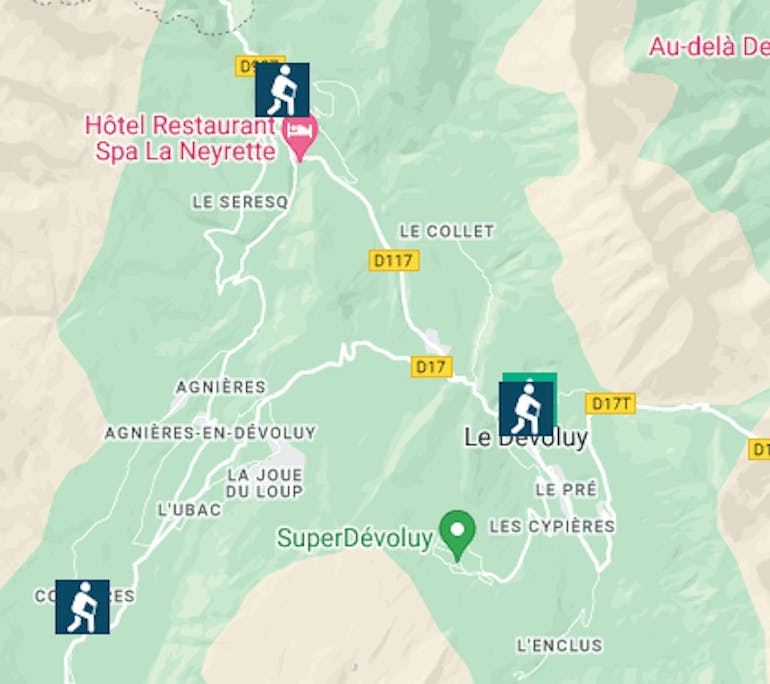
A route map showing generally where hikers will be on the Devoluy Massif self guided walking tour in the southern French Alps.

Inclusions & Exclusions

  • 7 nights of half-board accommodation at La Tourtette guest house

  • Breakfasts, Picnic Lunches, and Dinners

  • Return transfers from Veynes train station

  • Transportation to and from the start and finish points of your selected hikes and walks

  • Maps, GPX tracks, and route guidance for a variety of self-guided walks and hikes suitable for all levels

  • Access to a smartphone app containing all walk routes, GPX tracks, weather updates, maps, and local information for your convenience

  • The planting of a tree to help offset the carbon footprint of your trip.

  • Your journey to Veynes (we can help you organize this)

  • Drinks and spending money

  • Any additional activities, eg Via Ferrata (we can help you organize this)

  • Guiding services if booked

Pricing

Prices exclude flights to/from the destination.

Prices are for double room occupancy unless indicated otherwise.

  • Deposit per person

    25% of the trip price

  • Group of 4 Travelers - price per person

    $1,175 pp Contact us for pricing for your exact group size.

Sustainability

We are Travelife Certified and we plant a tree with our partner, Mossy Earth, for all our travelers as part of their rewilding program in Europe.

We operate a paperless office and all our communication with you and all your trip details will be given to you digitally via a smartphone app.

If you are traveling from Europe, we offer a 3% discount if you travel here by train rather than plane. To claim this please ask at booking. It is not accumulable with other discounts and the train journey needs to be international, eg Eurostar to France and then onward on local French TGV or trains.

Environmental Initiatives

Walking is a low-carbon activity and this tour is 100% accessible by train from anywhere in Europe so there is no need to hire a car. As you are staying in one place there are no baggage transfers, just short grouped lifts to the starts and ends of walks, minimizing transportation pollution.

By staying in one accommodation rather than changing every night, you are also saving on unnecessary washing, cleaning, and linen changes saving water, and energy, and reducing the usage of polluting cleaning products.

This is a great advantage for the environment but also a great comfort for you not to have to live out of a suitcase for a week!

Economic Initiatives

This tour exemplifies economic sustainability in the tourism industry by ensuring that the benefits are directly channeled into the local economy.

By opting for accommodations like La Tourtette guest house, which is independently owned and operated, the tour supports local businesses and contributes to the economic vitality of the region.

The choice of local transportation services further bolsters this approach. Such practices provide a more authentic experience for tourists and help sustain the local communities financially. By focusing on small-scale, locally owned entities, the tour avoids funneling its economic benefits to large, non-local corporations, thereby keeping the economic benefits within the community. This approach also often leads to a deeper and more enriching cultural exchange, as guests can interact closely with local hosts and service providers, gaining insights into the region's way of life, traditions, and values.

Sociocultural Initiatives

The tour demonstrates socio-cultural sustainability through various practices that respect and uplift the local culture and community.

By using local accommodations and services, the tour provides visitors with an authentic experience and encourages meaningful cultural exchanges. This approach helps preserve local traditions and customs, as guests may learn about and engage with the regional culture directly from the people who live it.

By staying in one place you will also get to know the locals much more deeply than a fleeting visit, helping in cultural exchanges and appreciation of each others' cultures.

Health & Safety

Be sure you have traveler's insurance.
It's recommended to be in good physical condition to do this trip.

FAQs

What does the physical rating of "Average" mean?

This tour can be adapted to any level. Whether you are looking for easy 2-hour walks or hard-core full-day mountain hikes, you'll enjoy this trip!

What are the accommodations like?

The accommodation's commitment to sustainability is evident through several key practices. Firstly, the use of ecologically friendly cleaning products significantly reduces the environmental impact. These products are typically made from natural, biodegradable ingredients that are less harmful to ecosystems than conventional cleaning agents. This approach minimizes water pollution while ensuring a healthier environment for guests and staff.

Water-saving devices are another critical aspect. These devices, such as low-flow showerheads and toilets, help reduce the overall water consumption of the hotel. This is particularly important in mountainous areas where water resources can be scarce. By minimizing water usage, the hotel conserves a vital natural resource and reduces its utility costs, creating an economically sustainable model.

Investing in energy efficiency is another key area. Tourtette is currently investing in using energy-efficient lighting and improving insulation. Such measures reduce the hotel's carbon footprint and decrease its long-term operational costs, making it a sustainable choice both environmentally and economically.

Finally, providing options to refill water bottles encourages guests to use reusable bottles instead of buying single-use plastic ones. This practice significantly reduces plastic waste, a major environmental issue, especially in natural settings like the Alps where preserving the pristine environment is crucial.

How should we arrive in Veynes?

You need to arrive at the Veynes train station for this self-guided walking tour. Veynes is on the TER train line from Grenoble, Valence, or Marseille, all of which are accessible by TGV train from Paris.

WE OFFER A 3% DISCOUNT TO ANYONE TRAVELLING BY TRAIN INSTEAD OF PLANE TO GAP FROM OUTSIDE OF FRANCE. To claim your 3% discount, you will need to show us proof of train travel for an international train route of over 3 hours that could have been taken by plane. Please ask when you book.

Please ask us for help to get here - we have become experts at this over the years!

Please note the train discount is not cumulable with other discounts.

What are the Walking & Hiking Grades?

  • Easy: Up to 4 hours daily on hiking trails, paths, tracks, or gentle terrain.
  • Moderate: Approximately 5 hours of walking each day on trails, with about 600 to 800 meters of ascent and/or up to 15 kilometers.
  • Difficult: Up to 6 hours daily, possibly off-trail, with about 700 to 1,000 meters of ascent and/or 15 to 18 kilometers. May include high-altitude routes.
  • Very Difficult: Over 6 hours of challenging walking off-trail or in rough terrain, exceeding 1,000 meters of ascent. Potential for high-altitude paths.

Who will love this trip?

If you love walking and hiking, and have a passion for the mountains, you will love this trip. There are a variety of walks for all levels but you do need to be walking fit to enjoy them. We have graded the walks by difficulty in the itinerary to help you choose what walks you would like to do and will also advise on a daily basis when you are here. Some of the more difficult hikes require navigation skills, a high level of fitness and sure footedness on steep slopes and scree. Other moderate and easy walks are on forest trails with 2 to 3 hours of walking at a steady pace. And there are a whole host of other options in between! 

Inquire Now

We proudly partner with wanderwell, a B-Corp-certified travel insurance agency and 1% for the Planet member.

Request a FREE quote for Trip Protection or Travel Medical coverage.

Book Insurance Now